3D model building (Photogrammetry)
My 3D modeling process using Agisoft Metashape: https://www.youtube.com/watch?v=Rbrq5x98JKo
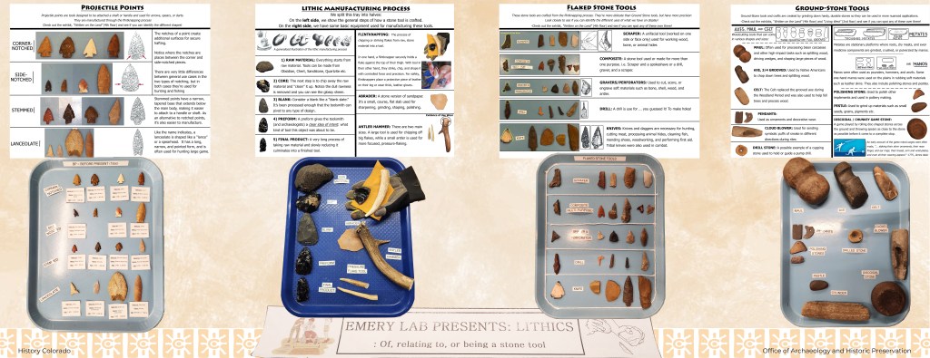
Emery Lab Display Sheets for the General Public
I designed these Display Sheets to bridge the Lab with the general public. They provide educational descriptions of different types of artifacts and materials.
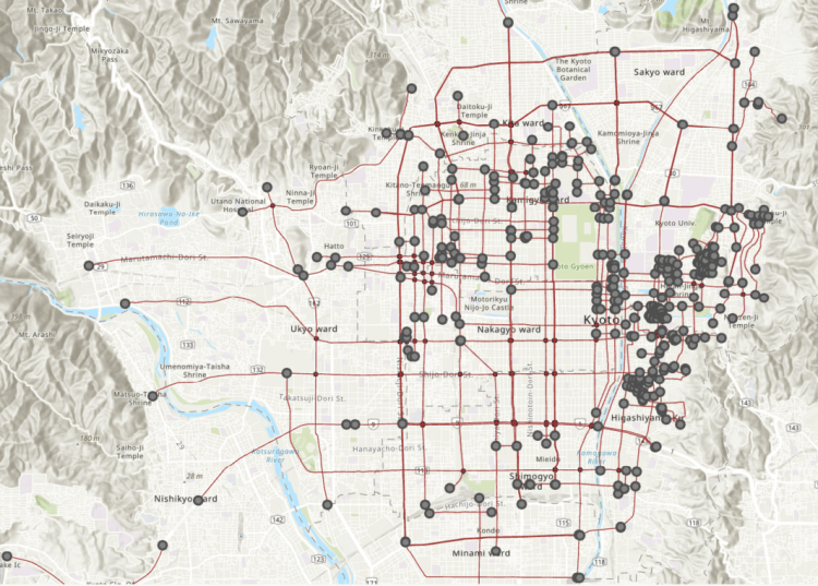
Network Analysis Map – Kyoto, Japan
A point and line map hand-made of Kyoto, Japan. Each line represents a road/street. Each point represents a shrine or temple. I created this map in ArcGIS to learn network analysis and other GIS applications.
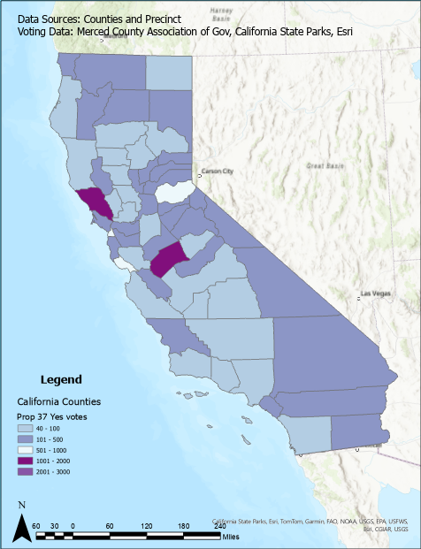
Voting Density GIS Map – Californian Counties
I created this to indicate votes per county in California with more votes shown in a darker color. The map also include a compass, legend, scale bar, and citation.
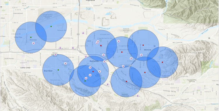
Buffer Analysis Map – Sightings of an Animal within schools
This GIS map displays sightings of certain animals within a certain radius or buffer to schools.
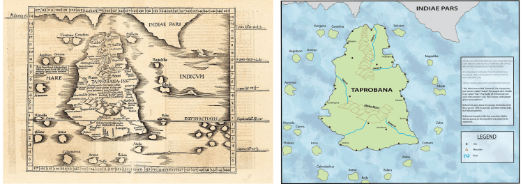
Modern Conversion Map – Ancient Taprobane (Sri Lanka)
The left is Ptolemy’s original map of what they assumed Taprobane (Sri Lanka) to be. On the right, I converted it to a more modern visual and translated the Latin names.
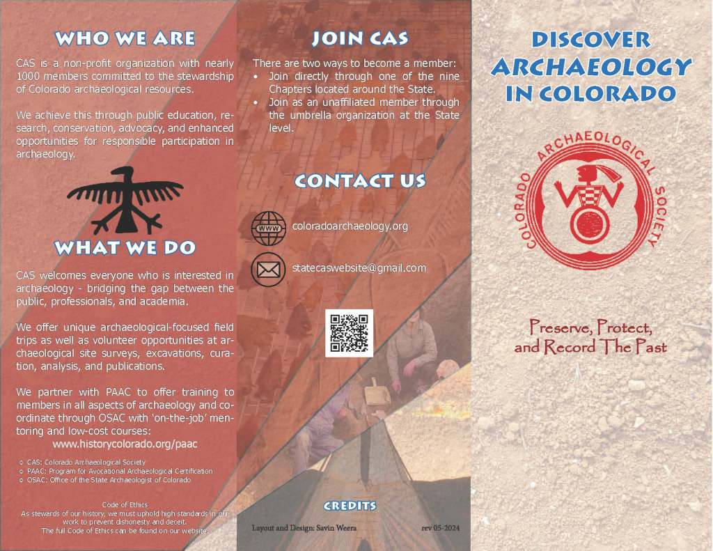
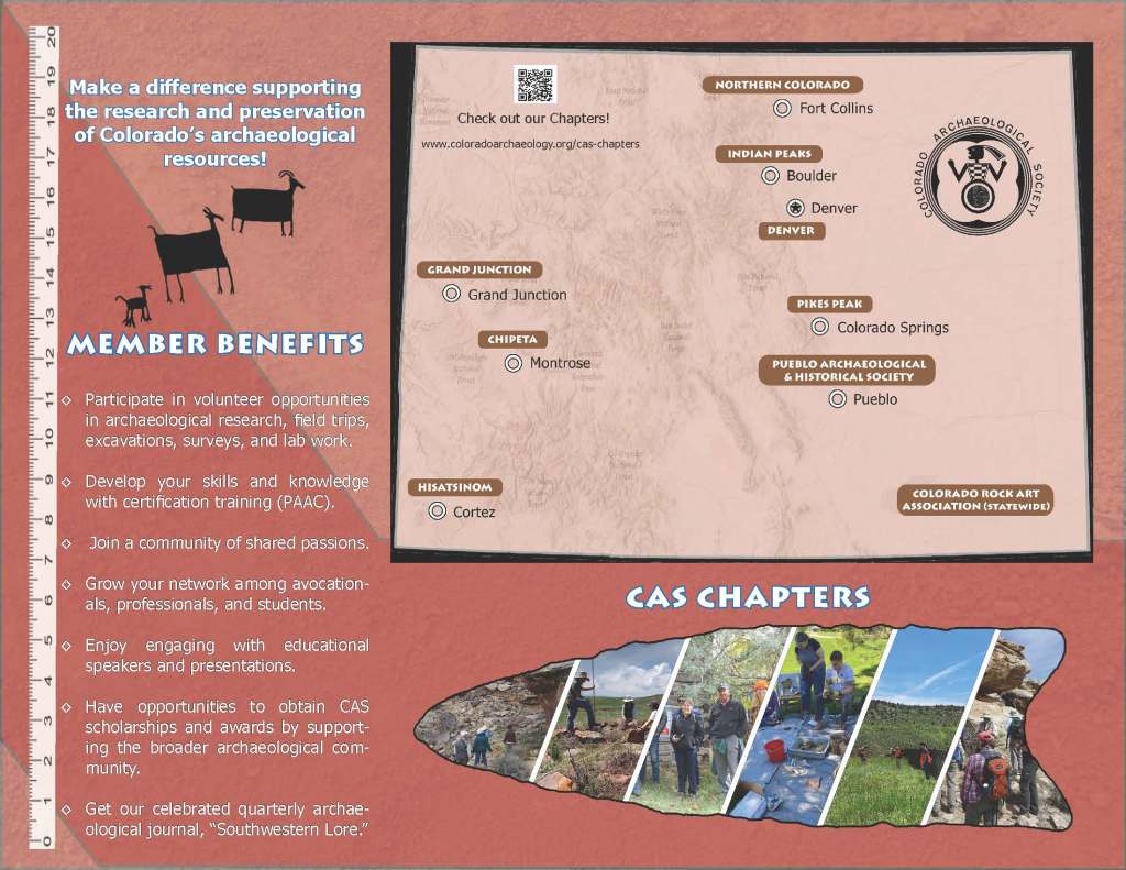
CAS brochures and promotional material I designed